Diamond Lake RV Park
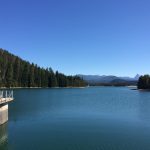
Once again I found that Crater Lake was like most National Parks; securing a campsite without a six month advance reservation was practically impossible. Luckily there was a Forest Service concessionaire at Diamond Lake just north of the National Park entrance, and they operated until the end of September. I made base camp here and took day trips South to Crater and North into the National Forest.
One advantage of Diamond Lake was it’s circled by a good bike trail, giving me my first real opportunity to try out my new folding bicycle.
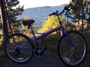
It uses quick-releases to collapse without tools, and takes up half the space of a full size mountain bike when folded. The bike passed its maiden voyage with flying colors, as it rapidly became apparent the limitations would come from the rider, not the machine. You may never forget how to ride a bike, but you do forget how much of a workout your legs get on the hills!
Crater Lake Auto Tour
After an afternoon of cycling, my half-century old body told me the next morning it would be a good day for motor touring in the truck. Diamond Lake is at about 5200 feet above sea level, so it had been a chilly night, and the heated seats in Peggy that had seemed a needless luxury sure were nice!
The experience at Crater Lake National Park is mostly driving around the rim and stopping often at the many overlooks. There are a few hiking trails, but the sides of the rim are so steep there are few places where you can reach the water, so you see much of the same sites by foot as you do by car.
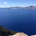
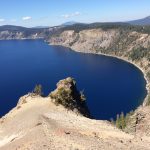
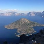
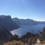
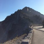
Crater Lake is breathtaking; the pictures speak for themselves. Here are a couple observations about the Park in general:
- The park entry is $25 per vehicle, which is one of the lower entrance fees for National Parks now. Best deal is the $80 annual America the Beautiful pass that gets you into most federal recreation sites. Mine has more than paid for itself.
- The concessionaire who runs the cafe at the Rim Village will hit you up for twelve bucks for a lunchmeat sandwich wrapped in plastic. I passed, but made the mistake of buying a cup of industrial wax flavored coffee. If you want to eat in the park, I’d suggest getting a table at the lodge restaurant.
- The Steel Visitor Center has a nice gift shop for postcards and a collection box for mailing them. The little post office is only open for a couple hours during lunchtime, so if you need to buy stamps go at noon.
- I really like how the Park Service makes an effort to maintain a natural experience, including little things like signage and the snow markers. Kudos guys – our tax dollars well spent!
Umpqua National Forest
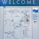
After a whole day getting in and out of the truck I was ready for something a bit slower paced the following day, so I backtracked a bit on Route 138 into the Umpqua National Forest. The campground host had advised that there were six waterfalls along that stretch of highway within 30 miles, so I strapped on my hiking boots and set out to see how many I could make it to.
As it turned out, the answer was four.
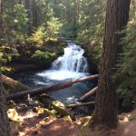
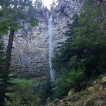
Whitehorse was first and the easiest waterfall to reach, located just a hundred feet down a decked path next to a nice little ten space USFS campground. It did little to prepare me for the second – Watson Falls. This is a .6 mile trail rated as “moderate” that goes up the side of a steep ridge. Lots of rocks and roots to navigate around and a climb that will get your heart going. The payoff is a nice low volume waterfall that drops 279 feet off the ridgetop.
Next came Toketee Falls. Unlike Whitehorse and Watson, Toketee is quite popular so you share the trail with a regular stream of other hikers. This is another half mile trail, but this one is better improved and has good handrails. That’s needed because the trail clings on the edge of a steep canyon. There are also over 200 stairs to navigate.
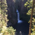
The trail ends at a viewing platform attached to a massive redwood tree that is rooted at the floor of the canyon fifty feet below. It affords an excellent view of Toketee Falls, which drops out of a gash in the rock to spill into a wide pool. There is a bench there, and it’s a great place to have lunch if you brought one. As I was eating my granola bar, I was joined by a 20-something hippie chick and a Millennial programmer from Los Angeles. He produced a jar of pickled asparagus out of his daypack and offered it around. We chatted a bit and enjoyed the scenery, until I began to feel like a third wheel and headed back, leaving the two young people alone. Their moment was brief though, as I encountered a noisy pack of romping Cub Scouts a couple minutes later heading to the falls. Alas, Romantis Interruptus!
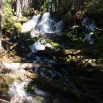
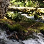
The final waterfall was my favorite. Not too far from the parking area, the icy Clearwater River chuckles across a boulder field in a wide gentle froth, and then reforms to wind through a fern banked vale. This stream is quite accessible, with wide banks that let you wander along the water below the falls. Not as dramatic as the higher, more rugged waterfalls I’d seen earlier, but very quiet and restful. The toad I met thought so too.
Four Waterfalls in One Day
A Fish-Friendly Hydroelectric Project
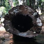
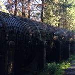
Next to the parking area at the Toketee Falls trailhead I’d seen this interesting wooden pipe-like thing. Nearby I found an info board that referenced the North Umpqua Hydroelectric Project. It sounded intriguing, so I headed down a gravel road into the backcountry to check into this thing further.
The Project is your basic rural electricity generation setup, with one unique twist: in order to get permission from the Forest Service, PacifiCorp (the operating utility) had to come up with a way to build dams that would not negatively affect the ecosystem of the rivers. They did this by cleverly dividing the flow in the watershed into two paths. One path is the existing rivers, where sufficient flow is always maintained to support the fish and other life in and around the streams. The second path is a network of canals, flumes and giant pipes like the wooden conduit I’d seen at Toketee. This water is controlled by the utility, so they can vary the flow based on electrical demand without impacting the environment in the watershed. Smart!
The North Umpqua Hydro Project is proof that you can have development and preservation at the same time, it just takes a little more effort and a willingness to compromise.
Next time: the Northern California coast


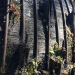
You’ve become a great hiker! Love how you are drawn to the seldom visited places and discover what makes them special. It’s interesting that the power company chose to use wood to build those aquaducts.
As I recall, they built the wooden part of the system around 1959. That choice didn’t surprise me, but the fact that those flumes are still in service today did. There were many squirting leaks and plenty of seepage, but it was still doing the job. Being soaked and under pressure for fifty years hasn’t destroyed all the planks – that’s a real testament to the durability of redwood.